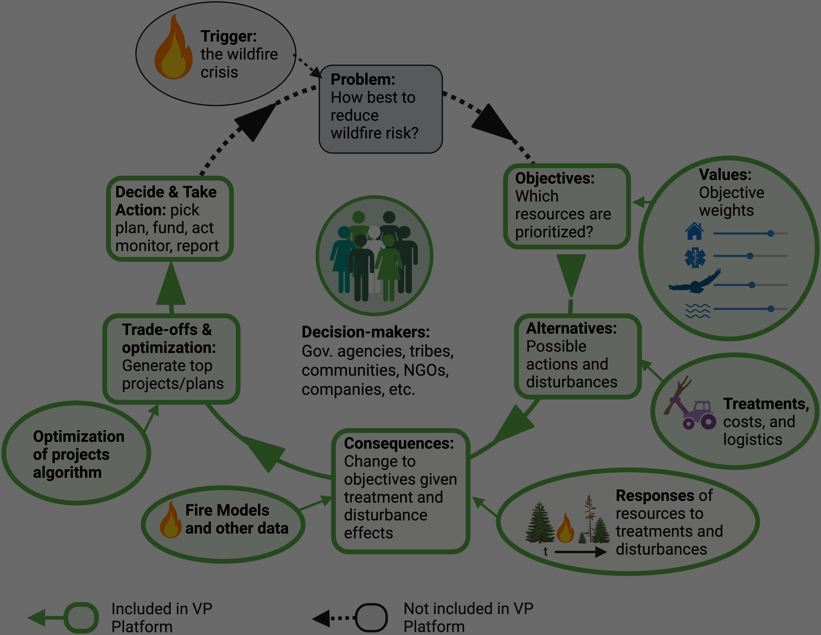
Learn about Pyrologix, the fire risk engine that powers Vibrant Planet
What are burn probability models?
Understanding where large wildfires are more likely to occur is essential to effectively manage risk. The map above shows wildfire burn probability – the likelihood of any given area experiencing a large wildfire in a given year – for the continental US, current to 2024 conditions. Maps representing burn probability across a landscape allow for targeted, proactive risk management strategies. As a result, they are widely used by land and fire management agencies, such as the USDA Forest Service (USFS).
Burn probability modeling allows communities, land managers, and policy makers to identify areas of concern before wildfires start. This information can then be used to implement preventative measures like home hardening, fuel reduction, and adopting new building codes. Given the magnitude of the wildfire problem and the limited resources available, Vibrant Planet and its subsidiary Pyrologix have built a platform to ensure our users have the most credible, reliable, and actionable information available to understand burn probability.
Burn probability models in action
Recently, we mapped burn probability for the state of Texas in advance of the 2024 fire year. Shown on the map are the perimeters of recent devastating fires, including the Smokehouse Creek Fire, the largest wildfire in recorded history in the state. One immediate observation is these fires occurred in areas with higher burn probability. The point is not that these specific fires could have been predicted in advance – that is a fool’s errand. The point, rather, is that this map helps land managers understand where fires are likely to burn in the future, and therefore where they could prioritize mitigation.

Let’s consider another example. The figure below is from the Wildfire Risk to Communities (WRC) website, which provides maps and resources to help communities understand, explore, and reduce wildfire risk. The WRC website and its underlying risk information are the result of a collaboration between the USFS, Headwaters Economics, and Pyrologix. Generated before the tragedy in Lahaina, Pyrologix burn probability modeling indicated that Maui County had a greater wildfire likelihood than 79% of counties in the US, and greater risk to homes than 83% of counties.

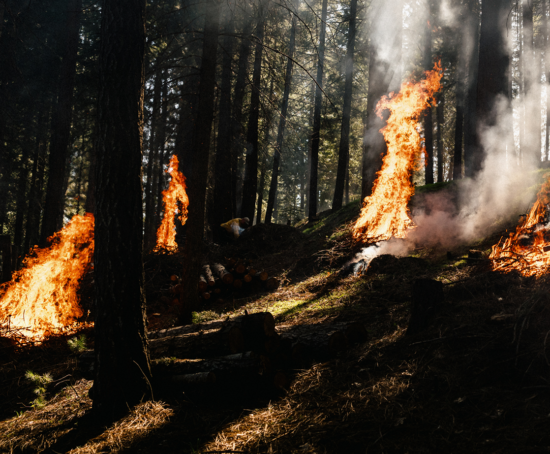
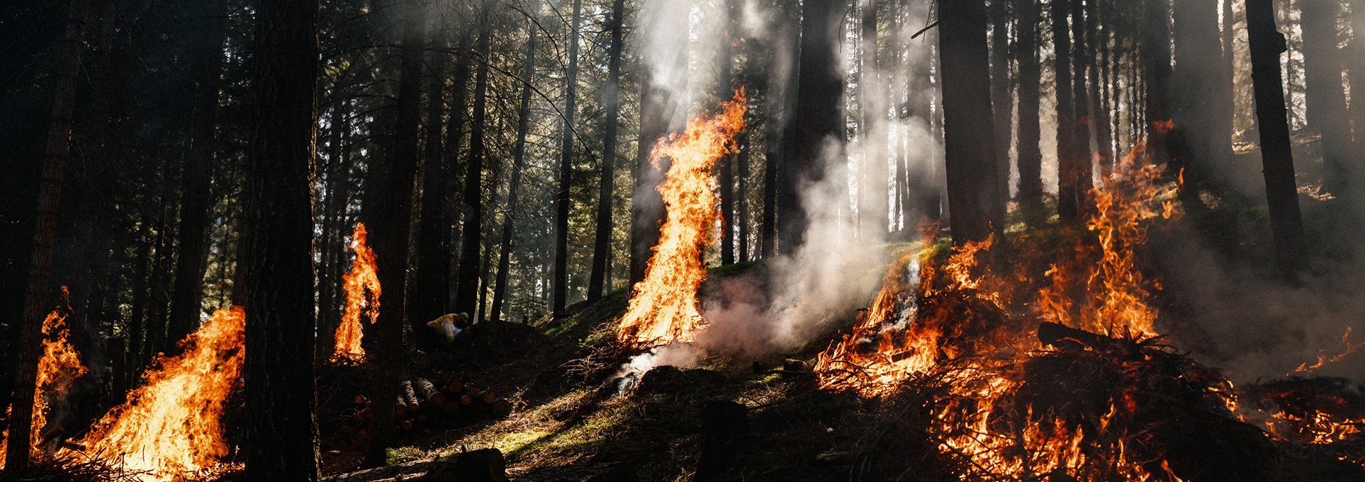
Burn probability modeling can also help demonstrate fire risk before and after treatments are implemented on a landscape. Recently, Vibrant Planet collaborated with multijurisdictional partners to prioritize a treatment across 275,000 acres in the North Yuba Watershed, near Downieville, California. Pyrologix burn probability modeling indicated promising post-treatment results:
- 90-100% reduction of risk to structures in Downieville and Sierra City (the most populated areas within the landscape)
- 90-100% reduction of burn probability in Downieville and Sierra City

How does burn probability modeling work?
The maps above leverage a powerful tool Pyrologix relies on called FSim, developed by fire scientists at the Missoula Fire Lab (USFS). FSim isn’t just a single model; it’s a comprehensive fire simulation system. Here’s a glimpse into how FSim helps create those burn probability maps.
- The power of simulation: FSim takes a probabilistic approach. It runs numerous simulations of wildfire events over a designated area and period of time. Each simulation considers various factors that influence fire ignition and behavior.
- Building the fire environment: Vegetation types, topography, and historical fire data are fed into the system. This creates a digital representation of the landscape, accounting for how these elements interact and influence fire likelihood.
- Weather’s role: FSim incorporates historical weather data and generates realistic weather patterns for each simulation. This accounts for the critical role of temperature, wind, and humidity in wildfire behavior.
- Simulating the flames: FSim’s core strength lies in simulating fire growth for thousands of possible ignition scenarios. It considers how fires ignite, spread, and interact with the landscape and weather elements discussed above. Think of it as running countless virtual wildfires under various conditions.
- The probability puzzle: After running numerous simulations, FSim analyzes the results. It calculates the percentage of simulations where fire burned in a specific area. The percentage becomes the burn probability for that location.
Pyrologix expertise
FSim is the engine, but Pyrologix’s expertise is also an essential piece of the equation. The team has delivered burn probability modeling results spanning the entire nation – calibrating FSim’s fire occurrence and behavior models using real-world fire data and scientific understanding. This ensures the simulations accurately reflect real-world fire dynamics. It is important to note that burn probability models are not perfect, and cannot predict the future with certainty. Pyrologix and Vibrant Planet are dedicated to delivering results that are credible and useful, and we’re always improving our modeling, calibration, and validation techniques.
The quest for continual improvement
- Data reigns supreme: Pyrologix actively seeks to incorporate new, better data sources into FSim. They spend a great deal of time curating and refining data inputs – as the saying goes, “garbage in, garbage out.” The more comprehensive the data, the more realistic the simulations become.
- Calibration is key: Fire behavior is complex, and models require ongoing calibration to ensure accuracy. Pyrologix scientists and modelers compare FSim’s predictions with real-world fire events. This allows them to refine the models for even greater precision.
- Validation matters: Validation goes beyond calibration. Past models have shown strong alignment with patterns of future area burned, and Pyrologix is actively working to improve their validation techniques.
Benefits of continuous improvement
By persistently and diligently refining their modeling techniques, Pyrologix ensures that burn probability modeling remains a valuable tool for wildfire risk management. Here’s how:
- Enhanced accuracy: Improved data, calibration, and validation lead to more accurate burn probability maps. This allows managers and communities to make data-driven decisions about risk reduction strategies.
- Greater confidence: As the model’s accuracy increases, so does the confidence in its predictions. This empowers more proactive preparation for wildfire threats.
- Better decision-making: More precise burn probability maps allow for targeted risk mitigation efforts. Resources can be allocated efficiently to areas with the greatest wildfire risk.
Burn probability modeling: a continuously evolving tool
The growing use and sophistication of FSim is a powerful testament to the value of advanced modeling in wildfire risk management. Pyrologix’s unwavering commitment to improvement ensures that burn probability modeling remains at the forefront of this field. By continuously refining their modeling techniques, Pyrologix provides a range of stakeholders with the most up-to-date and accurate information to build safer and more fire-resilient futures. Stay tuned for more.